World Maps
The new official layout of the world — free PDF downloads
On 4 September 2026 the United Nations General Assembly voted to retire the 1569 Mercator projection and adopt the Equal Earth map — the new official layout of the world, championed by Togo on behalf of the African Union. The vote passed 164 to 1.
On the old Mercator map, Africa looks roughly the size of Greenland. In reality, Africa is 14 times larger — you could fit the United States, China, India, Japan, Mexico and much of Europe inside it, with land to spare. Equal-area maps like Equal Earth show every country at its true size relative to every other.
The Equal Earth maps are public domain, so we're offering them here as free, print-ready PDFs — perfect for classrooms, offices or the wall at home.
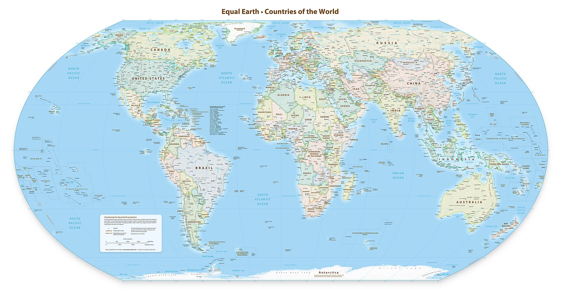
Equal Earth Political Map — Africa & Europe
Centred on the Greenwich meridian (0°) — the layout adopted by the UN General Assembly
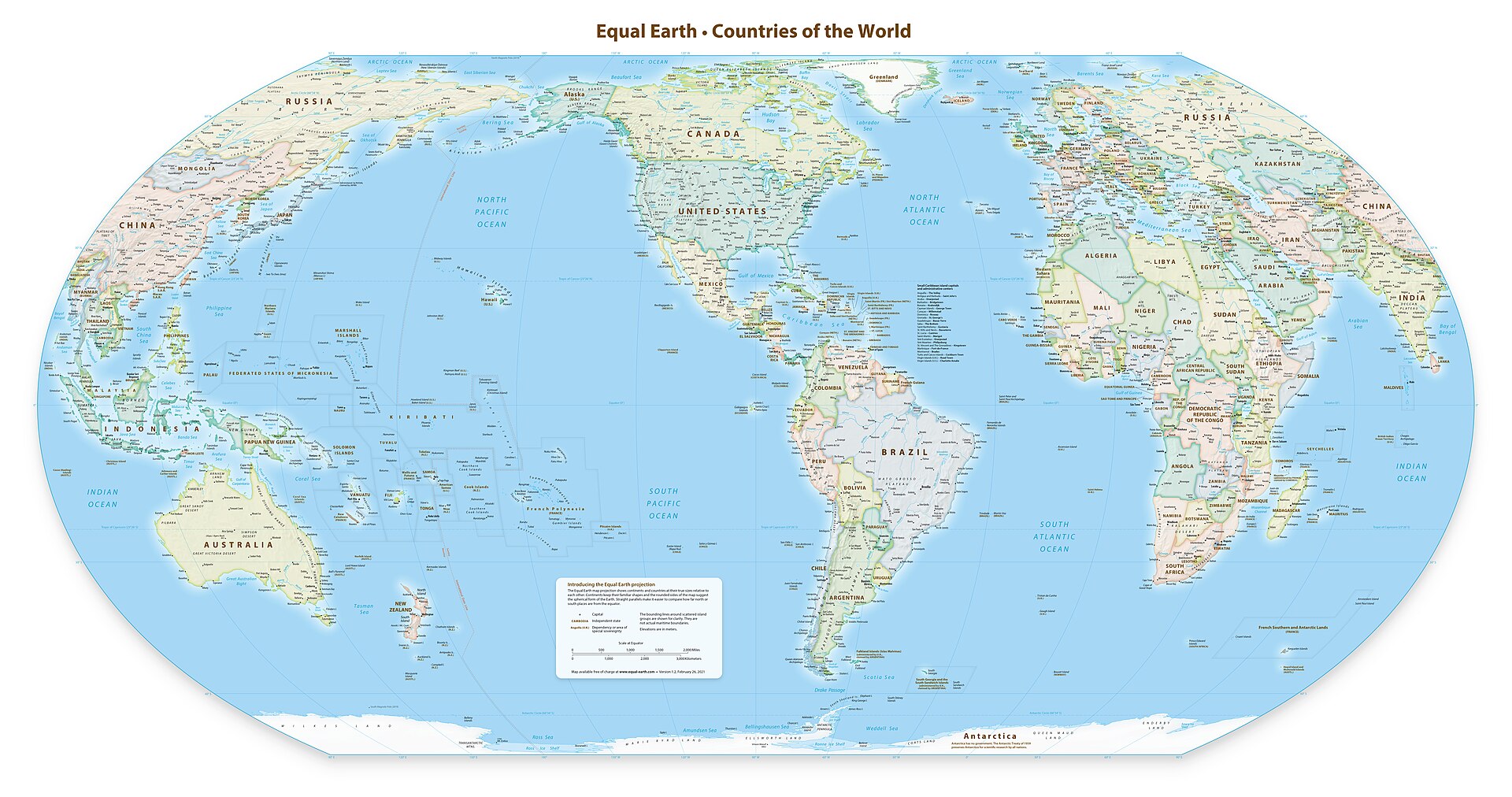
Equal Earth Political Map — The Americas
Centred on 90° West — the Americas at their true size
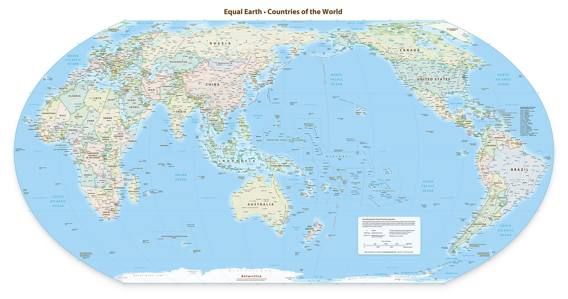
Equal Earth Political Map — Asia & Oceania
Centred on 150° East — Asia and Australia at their true size
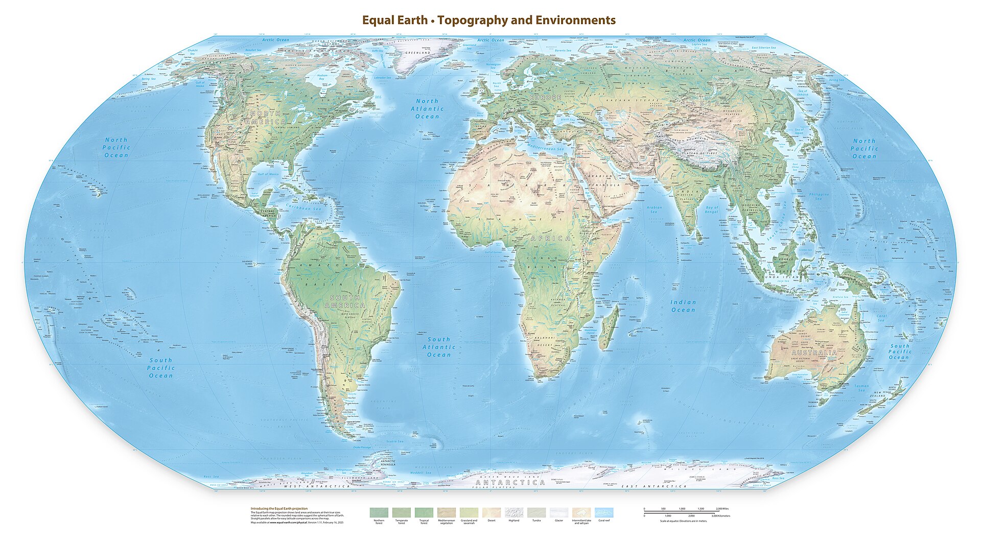
Equal Earth Physical Map — The Natural World
Terrain, rivers, land cover and the ocean floor in the UN-adopted projection
PDFs are A3 landscape and scale up cleanly for larger prints.